Category:Walton, Warwickshire
Jump to navigation
Jump to search
village in Warwickshire, UK | |||||
| Upload media | |||||
| Instance of | |||||
|---|---|---|---|---|---|
| Location | Wellesbourne and Walton, Stratford-on-Avon, Warwickshire, West Midlands, England | ||||
 | |||||
English: Walton is a small Hamlet just south of Wellesbourne in Warwickshire, England. It is next to the River Dene and is most notable for Walton Hall which is now an hotel and spa. It is home to the Hamiltons who own the land. The closest village is Wellesbourne.
Subcategories
This category has the following 2 subcategories, out of 2 total.
S
- St James' Church, Walton (3 F)
W
Media in category "Walton, Warwickshire"
The following 65 files are in this category, out of 65 total.
-
 Barn near Walton - geograph.org.uk - 2497104.jpg 640 × 422; 62 KB
-
 Bridleway near Walton - geograph.org.uk - 2498852.jpg 640 × 480; 99 KB
-
 Bridleway to Walton Hall - geograph.org.uk - 2498579.jpg 640 × 480; 108 KB
-
 Buildings at Walton Hall - geograph.org.uk - 2498251.jpg 640 × 446; 81 KB
-
 Cottage in Walton - geograph.org.uk - 5712340.jpg 1,024 × 680; 256 KB
-
 Cottage in Walton - geograph.org.uk - 5712342.jpg 1,024 × 680; 306 KB
-
 Dene valley near Walton - geograph.org.uk - 2497122.jpg 640 × 480; 107 KB
-
 Drive to The Old Rectory, Walton - geograph.org.uk - 2497305.jpg 640 × 452; 108 KB
-
 Drive to The Old Rectory, Walton - geograph.org.uk - 2497307.jpg 640 × 480; 88 KB
-
 Driveway to Mount Pleasant Farm - geograph.org.uk - 117192.jpg 640 × 480; 55 KB
-
 Ewe and lambs near Walton Park - geograph.org.uk - 5714220.jpg 1,024 × 680; 248 KB
-
 Farmland and Walton Wood - geograph.org.uk - 5714216.jpg 1,024 × 680; 241 KB
-
 Farmland at Walton Farm - geograph.org.uk - 4163295.jpg 2,592 × 1,944; 1.96 MB
-
 Farmland at Walton Hill Farm - geograph.org.uk - 4163215.jpg 2,592 × 1,944; 1.68 MB
-

-
 Fenced drive, Walton - geograph.org.uk - 2498696.jpg 640 × 437; 77 KB
-
 Field and road at Walton - geograph.org.uk - 2497241.jpg 640 × 480; 75 KB
-
 Field, Walton - geograph.org.uk - 2497302.jpg 640 × 480; 81 KB
-
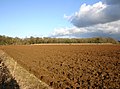
 Fields Near Walton - geograph.org.uk - 801879.jpg 640 × 480; 118 KB
-
 Fields near Walton Hall - geograph.org.uk - 1701619.jpg 2,000 × 1,478; 316 KB
-
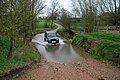
 Ford at Walton - geograph.org.uk - 2342038.jpg 640 × 439; 92 KB
-
 Ford at Walton - geograph.org.uk - 5712346.jpg 800 × 531; 168 KB
-
 Ford near Walton - geograph.org.uk - 2470369.jpg 640 × 480; 124 KB
-
 Ford near Walton - geograph.org.uk - 2497081.jpg 640 × 480; 117 KB
-

-
 Gatepost, Walton Hall - geograph.org.uk - 2497948.jpg 480 × 640; 100 KB
-
 Gateway by road south of Walton - geograph.org.uk - 2497310.jpg 640 × 451; 103 KB
-
 Green at Walton - geograph.org.uk - 2497217.jpg 640 × 480; 120 KB
-
 Grounds of Walton Hall - geograph.org.uk - 2498238.jpg 640 × 480; 110 KB
-
 Lake at Walton Hall - geograph.org.uk - 2470793.jpg 640 × 480; 93 KB
-
 Lake at Walton Hall - geograph.org.uk - 2497986.jpg 640 × 480; 108 KB
-

-
 Oak near Walton Hall - geograph.org.uk - 2497931.jpg 640 × 480; 92 KB
-
 Oak trees south of Walton - geograph.org.uk - 2497313.jpg 640 × 480; 98 KB
-
 Oak trees south of Walton - geograph.org.uk - 2497317.jpg 640 × 480; 107 KB
-
 Oaks at Walton - geograph.org.uk - 2497304.jpg 480 × 640; 145 KB
-
 Ornamental trees near Walton Hall - geograph.org.uk - 2497378.jpg 640 × 480; 90 KB
-
 Parkland at Walton Hall - geograph.org.uk - 2498308.jpg 640 × 480; 74 KB
-
 Parkland at Walton Hall - geograph.org.uk - 2498331.jpg 640 × 480; 96 KB
-
 River Dene at Walton Ford - geograph.org.uk - 2497086.jpg 640 × 475; 140 KB
-
 River Dene Valley near Walton - geograph.org.uk - 4938737.jpg 4,590 × 3,450; 3.84 MB
-
 Road near Walton Hall - geograph.org.uk - 2497342.jpg 640 × 480; 92 KB
-
 Road passing through Walton Park - geograph.org.uk - 5712321.jpg 1,024 × 680; 266 KB
-
 Sheep grazing south of Walton Hall - geograph.org.uk - 4163357.jpg 2,592 × 1,944; 1.88 MB
-
 Telephone box, Walton - geograph.org.uk - 2497232.jpg 640 × 480; 92 KB
-
 The Old Rectory, Walton - geograph.org.uk - 2498800.jpg 640 × 480; 102 KB
-
 Track near Walton Hall - geograph.org.uk - 2470831.jpg 640 × 458; 90 KB
-
 Track near Walton Hall - geograph.org.uk - 2470850.jpg 640 × 474; 89 KB
-
 Trees at Walton Hall - geograph.org.uk - 2498281.jpg 640 × 480; 101 KB
-
 Turn left for Loxley. - geograph.org.uk - 88728.jpg 640 × 477; 60 KB
-
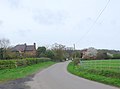 Walton - geograph.org.uk - 2458101.jpg 640 × 475; 49 KB
-
 Walton Farm - geograph.org.uk - 2497215.jpg 640 × 438; 85 KB
-
 Walton Ford - geograph.org.uk - 2891283.jpg 3,872 × 2,592; 2.39 MB
-
 Walton Ford - geograph.org.uk - 3803959.jpg 2,000 × 1,399; 885 KB
-
 Walton Ford - geograph.org.uk - 3803968.jpg 2,000 × 1,333; 837 KB
-
 Walton Ford - geograph.org.uk - 5022843.jpg 2,000 × 1,500; 1.55 MB
-
 Walton Hall - geograph.org.uk - 2497997.jpg 640 × 452; 81 KB
-
 Walton Hill Farm - geograph.org.uk - 4938105.jpg 1,600 × 1,113; 645 KB
-
 Walton Park - geograph.org.uk - 2343417.jpg 640 × 471; 85 KB
-
 Walton Wood - geograph.org.uk - 2458126.jpg 640 × 480; 70 KB
-
 Walton, the west end of the village - geograph.org.uk - 2497289.jpg 640 × 480; 80 KB
-
 War memorial and cottage in Walton - geograph.org.uk - 5712324.jpg 1,024 × 680; 284 KB
-
 War Memorial in Walton - geograph.org.uk - 5712338.jpg 680 × 1,024; 332 KB
-
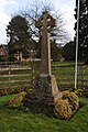
 War memorial, Walton - geograph.org.uk - 2497222.jpg 640 × 480; 87 KB
-
 Whitfield Brake - geograph.org.uk - 1702217.jpg 2,000 × 1,478; 349 KB


